 Madeira Trip Guide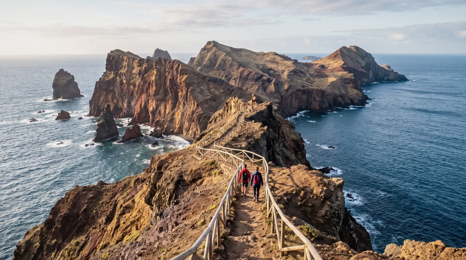
Ponta de São Lourenço
Ponta de São Lourenço is the easternmost peninsula of Madeira's main island, a volcanic arm that Visit Madeira puts at nine kilometres long, with low vegetation, no trees and wind from the north. The walk here is the PR8 trail, the Vereda da Ponta de São Lourenço, from the Baía d'Abra car park out to Cais do Sardinha and back. Since 1 January 2026 it needs a booked slot on the SIMplifica portal, and non-resident visitors over 12 pay the trail fee. If you would rather let someone handle the road, the Caniçal transfer for the PR8 hike includes the permit. This page covers the route, the reserve, the heat and the boat alternative.
Quick answer Distance, fee, no shade, and the boat alternative
PR8, the Vereda da Ponta de São Lourenço, runs 4 km each way from the Baía d'Abra car park to Cais do Sardinha on Madeira's eastern tip. It is open, on the IFCN register, and since 1 January 2026 every walker over 12 who is not a Madeira resident books a slot on SIMplifica and pays $5.17 (€4.50). The path is undulating and in good condition but carries no shade at all, so carry water and start early. If the ridge sounds too hot or too windy, see the same cliffs from the water on the snorkeling boat trip from Quinta do Lorde marina.
Key takeaways
- The register distance is 4 km each way, about 8 km of walking in total. The older trailhead board still says 3 km. The figures table sets the sources side by side.
- Every classified PR needs a SIMplifica booking and a fee for non-residents over 12. Book on the official portal.
- No trees means no shade. Heat, wind and unstable cliff edges are the real risks on this trail, not distance. See the heat section.
- Do not want the walk at all? The snorkeling boat trip covers the cliffs from the water in two hours, or the Caniçal transfer drops you at the trailhead with the permit sorted.
Key facts
Opening hours
| PR8 entry | Booked slot–Slot times on SIMplifica |
|---|
Closed Open, per the IFCN register. Slot availability on SIMplifica decides when you can enter
Admission
- Adult
- PR8 slot $5.17 (€4.50)
- Reduced
- not stated
- Free
- Residents, children 12 and under, 60%+ disability and one companion. All must still book
Planning it
- Time needed
- The IFCN trailhead board gives 2 h 30 min and Visit Madeira estimates 2:30 hours. Neither says whether that is one way or includes the return
- Book ahead
- Recommended — a few days
- Address
- Baía d'Abra car park, end of the road east of Caniçal, Machico municipality
PR8 Slot, Transfer and Boat Trip Prices
Three ways to put Ponta de São Lourenço in your day, compared by price and what each includes. The slot price comes from the IFCN fee schedule and the tour prices from the operator listings.
Do you want to walk the ridge, or see the cliffs from the water? The IFCN slot is the only option if you want to hike it independently without a car. The transfer solves the road and the paperwork in one booking. The boat trip skips the trail entirely.
| Option | Price | What you get | Cancel | Book |
|---|---|---|---|---|
| IFCN slot, PR8Independent walkers with their own transport to Baía d'Abra | $5.17 (€4.50) | Entry slot on the trail for one non-resident over 12. Slots are capacity limited | Refund only if IFCN closes the trail | Official site |
| Caniçal transfer for the PR8 hikeWalkers without a hire car who want the permit handled | $36.00 | Shared round-trip transfer from Funchal, Caniço, Santa Cruz or Machico, PR8 trail permit included per the listing, self-guided hike with a digital map, 6 hours | Free up to 24 hours before | Check Availability |
| Ponta de São Lourenço snorkeling boat tripSwimmers who want the peninsula from the sea, no hiking | $46.00 | Two hours on the water along the cliffs from Quinta do Lorde marina, wetsuit, mask, snorkel, fins and guide included. No trail access | Free up to 24 hours before | Check Availability |
Of the three rows only the Caniçal transfer includes the trail permit per its listing. The IFCN slot must be booked separately by everyone else who steps onto PR8. Figures current in Q3 2026.
Ponta de São Lourenço Transfers and Boat Trips Compared
The PR8 transfer and the snorkeling boat trip are the two listings built around the peninsula. The two east Madeira day tours below do not list a Ponta de São Lourenço stop, so read their descriptions before assuming you will see it. Prices are the operators' USD figures.
 from $36.00
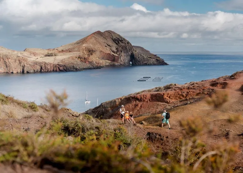
Caniçal Transfer for the PR8 Ponta de São Lourenço Hike
A shared transfer to the PR8 trailhead at Ponta de São Lourenço, Madeira's easternmost tip, with the trail permit and a digital map included.
Check Availability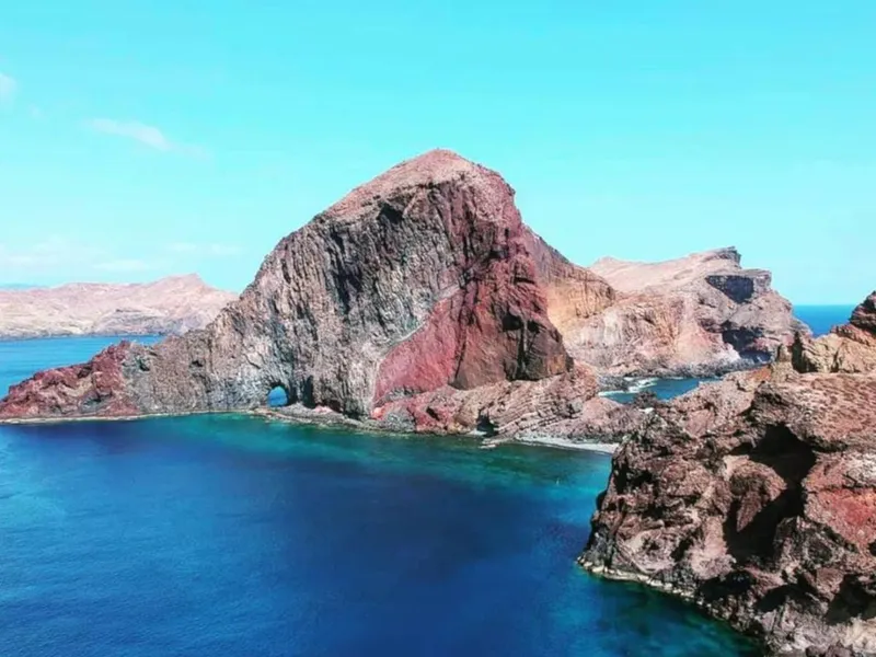 from $46.00
Ponta de São Lourenço Snorkeling Boat Trip
A boat trip along the cliffs of Ponta de São Lourenço with a snorkeling stop, gear included, departing from Quinta do Lorde marina.
Check Availability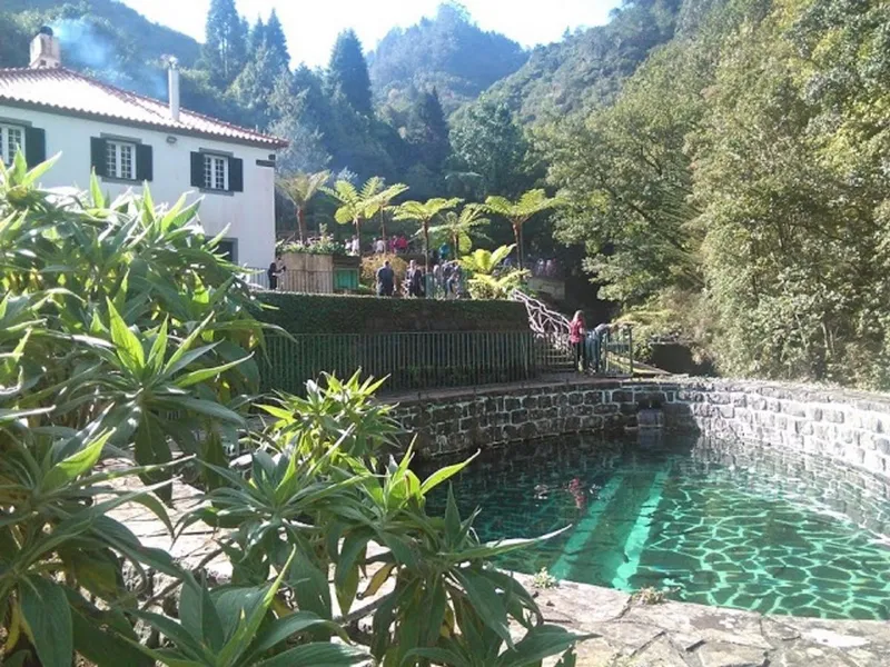 from $40.00
Eastern Madeira Full-Day Tour with Rum Tasting
An 8 hour eastern Madeira circuit with the Balcões walk, Santana's thatched houses, a rum tasting at Porto Cruz and free entry to the Guindaste skywalk.
Check Availability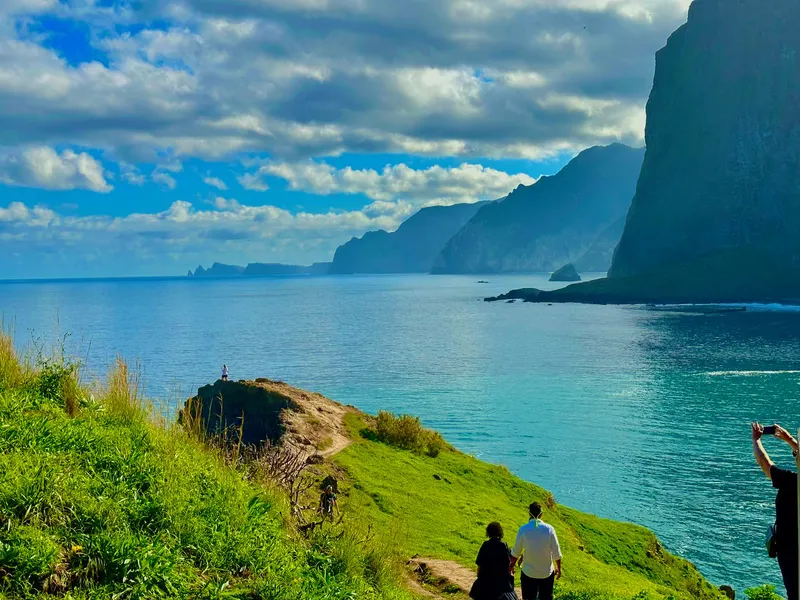 from $46.00
East Madeira Island Guided Tour & Laurissilva Walk
A guided east Madeira day trip with a walk through the UNESCO-listed Laurissilva forest and hotel pickup from the Funchal area.
Check AvailabilityPrices, ratings and details are the platform's own. dollar figures are the listed prices — the platform bills in your account's currency.
The PR8 Route From Baía d'Abra to Cais do Sardinha
The trail starts at the Baía d'Abra car park at the end of the road east of Caniçal and runs out along the peninsula to Cais do Sardinha. Visit Madeira describes an undulating path in good condition, with sea views over the north and south sides. The map pins both ends.
From the Stone Wall to the Ridge
Everything from the stone wall at Baía d'Abra belongs to the Regional Government and is part of the Madeira Natural Park, so the trail crosses protected ground from the start. The path is mostly basalt underfoot, with some limestone sediment formations in the rock according to Visit Madeira. It is low ground by Madeira standards.
The IFCN board's highest point is 126 m and its lowest is 23 m, so this is nothing like a mountain walk. What you get instead is exposure, because the peninsula carries only low vegetation. To the south you look toward the Desertas Islands, to the north toward Porto Santo.
The End of the Path at Cais do Sardinha
The register gives the route as Baía D'Abra to Cais do Sardinha, 4 km plus 4 km return. The older IFCN trailhead board names the finish Casa do Sardinha and marks information and toilets there. Visit Madeira suggests a swim at Cais do Sardinha at the end of the walk, and no lifeguard is mentioned in any of our sources, so swimming is at your own judgement.
The same care applies on the way out as on the way in. Do not go near the cliff edge. Many places are unstable, which the IFCN board prints as a formal caution, not a suggestion.
Booking Before You Set Foot on It
Since 1 January 2026 every classified PR trail on Madeira needs a prior booking on the SIMplifica portal. IFCN takes no bookings or payments at its offices or at the trailhead, which matters here because the trailhead is a car park at the end of a road. There is no counter to walk up to.
Slots are capacity limited and split by entry time, with about 15 minutes' tolerance. Same-day and next-day bookings are possible while slots remain. The fee for a non-resident over 12 on a single trail is $5.17 (€4.50), and residents, children 12 and under, and people with a 60% or higher disability plus one companion go free but must still book.
The full rules sit in our trail fee guide. If you would rather not deal with the portal at all, the Caniçal transfer for the PR8 hike includes the permit per its listing.
PR8 in Figures: Register, Trail Board and Visit Madeira
Three official sources describe this trail and they do not fully agree, so they are set side by side here. The IFCN register is the current record. The printed board at the trailhead is older. Visit Madeira, the regional tourism board, adds a difficulty word and a duration.
The distance question comes up most often. The IFCN register, which is the authority that manages the trail, lists 4 km plus 4 km return. The older board at Baía d'Abra still prints 3 km.
Visit Madeira's separate peninsula page mentions a 6-kilometre round trip, which we do not repeat as fact because it matches neither. On duration, the board gives 2 h 30 min and Visit Madeira estimates 2:30 hours. Neither source says whether that covers one way or the return as well, so treat it as a rough figure and allow extra for stops (our estimate).
Visit Madeira calls the difficulty moderate.
| Figure | Value | Source |
|---|---|---|
| Distance | 4 km each way | IFCN register |
| Distance on the older board | 3 km | IFCN trailhead board |
| Duration | 2 h 30 min, not labelled one way or return | IFCN trailhead board and Visit Madeira |
| Difficulty | Moderate | Visit Madeira |
| Highest point | 126 m | IFCN trailhead board |
| Lowest point | 23 m | IFCN trailhead board |
| Fee | $5.17 (€4.50) | IFCN fee schedule |
A Nature Reserve With a Footpath Through It
The whole peninsula is protected ground, and the protections stack in layers. Knowing them explains both the rules at the trailhead and what you might see on the water.
The Legal Layers
From the stone wall at Baía d'Abra the area belongs to the Regional Government and sits inside the Madeira Natural Park. The peninsula is a partial natural reserve, and the Desembarcadouro islet is a total natural reserve, the strictest category. The land, and the sea down to 50 m depth on the north coast, is a Natura 2000 site.
The semi-arid climate and the north winds explain the low vegetation and the absence of trees, which is why this corner looks nothing like the laurel forest of the island's interior.
What Lives Here
At sea you may see the Mediterranean monk seal, the lobo-marinho, which the IFCN board lists as a possibility from this coast. Visit Madeira counts one of the largest seagull colonies in the region here, plus protected seabirds including Cory's shearwater and Bulwer's petrel. The peninsula itself is volcanic and carries two islets at its tip: Cevada, also called Metade or Desembarcadouro, and Ponta de São Lourenço, also called Farol or Fora.
The peninsula is named after the caravel sailed by João Gonçalves Zarco, one of the three discoverers of Madeira. If the seabirds and seals appeal more than the ridge does, the snorkeling boat trip puts you on the water where they are.
No Trees, No Shade: Heat, Wind and the Cliff Edge
This is the section that should shape your start time. The peninsula is the driest, most exposed corner of Madeira, and the trail offers nowhere to hide from sun or wind.
The IFCN board gives the cause and the consequence: a semi-arid climate, north winds, low vegetation and no trees, and its printed caution is to carry water. No official climate normal is published for the peninsula itself. For context only, the IPMA normal for the Funchal station is a mean daily high of 26.8°C in August with 1.3 mm of rain.
The practical decisions:
- Book the earliest slot that works for you. The midday sun on bare rock is the main problem, and there is no shade to wait it out (our advice).
- Carry more water than you think you need. The board says carry water, and it marks no water point along the path.
- Expect wind from the north. The board names the north winds as the reason the peninsula has no trees.
- Stay back from the cliff edge. The board warns that many places are unstable.
- Swimming at Cais do Sardinha is Visit Madeira's suggestion. No lifeguard is mentioned in any source, so the sea is your own call. See the safety page.
Getting to Baía d'Abra: Car, Bus, Taxi or Transfer
The trailhead is at the end of the road east of Caniçal, in the Machico municipality. There is no ticket office at the end of that road, so book the slot before you set off, however you get there. If you land at Madeira's airport, that page covers the transfer options.
By Hire Car
A hire car is the flexible option. The IFCN board's map marks parking at Baía d'Abra, but no capacity or fee is published, so arrive in good time for your slot. Compare options on the car hire page, and read getting around Madeira for the road picture.
Bus, Taxi and Transfer
The IFCN board marks a bus stop at Baía d'Abra, but no official route number or timetable to the trailhead appears in our sources. The eastern buses have run under the SIGA system since July 2024, with the old SAM company now called CAM. Check current routes on our getting around page.
The board itself prints a useful number for the last leg: Táxis Caniçal, +351 291 961 989. If you want the whole transport problem solved in one booking, the shared Caniçal transfer for the PR8 hike picks up in Funchal, Caniço, Santa Cruz and Machico and includes the trail permit, at $36.00 for a 6-hour window. The taxi page covers private options.
Seeing the Cliffs From the Water Instead
Not everyone wants the walk. The peninsula's protected sea, its seabirds and the chance of a monk seal can also be looked for from a boat.
Azul Diving runs the Ponta de São Lourenço snorkeling boat trip from Marina Quinta do Lorde, with parking directly at the marina. It lasts two hours and costs $46.00, and the price includes a wetsuit, mask, snorkel, fins and a snorkeling guide. The operator states the trip is weather-dependent and conditions can change quickly.
No diving certification is needed, but the listing is aimed at confident swimmers. For a wider look at boat trips around the island, see whale watching in Madeira and the Desertas Islands, which the IFCN board points out on the southern horizon from the trail.
How Much Time To Give Ponta de São Lourenço
The peninsula can be a short stop or most of a morning, and the answer depends on how far you walk. Here are three plans, with the official time figures where they exist and what each leaves out.
The board's 2 h 30 min duration does not say whether it is one way or the return, so plan conservatively. Our estimate is that walkers who stop for the views and the swim at Cais do Sardinha should give the trail the better part of a morning or afternoon, on top of the drive from Funchal or the transfer window.
| Plan | What you get | What it skips | Time on record |
|---|---|---|---|
| Out to the first viewpoints and back | The first views over both coasts from the start of the path | Cais do Sardinha, the islets up close, and the swim | Not stated. A stop you size yourself, slot still required |
| PR8 to Cais do Sardinha and back | The full 4 km each way, both coasts, the islets, and Visit Madeira's suggested swim at the end | Nothing on land, but you still see the cliffs from above only | IFCN board 2 h 30 min, Visit Madeira 2:30, neither labelled one way or return |
| Snorkeling boat trip | Two hours under the cliffs with a swim stop, gear and guide included | The trail itself and the ridge views on foot | 2 hours per the operator |
If you are building the east of the island into a short stay, Madeira in 3 days and Madeira in 5 days show where a half-day walk fits, and the day trips page covers the other trips out from Funchal.
On PR8: What To Do, and What Not To
Short rules, all of them traceable to the IFCN board, the booking system or the reserve status.
Do
- Book your SIMplifica slot before you drive out, at $5.17 (€4.50) for non-residents over 12.
- Carry water. The board prints it as a formal caution because there is no shade and no supply point.
- Pick an early slot. There is no shade anywhere on the path.
- Look for Cory's shearwaters, Bulwer's petrels and, with luck, the Mediterranean monk seal offshore.
- Save the emergency number 112, and Proteção Civil on +351 291 700 112, which is printed on every IFCN trail board.
Don't
- Do not go near the cliff edge. The board warns many places are unstable, and it means it.
- Do not expect to pay at the trailhead. IFCN takes no bookings or payments there, and a full slot is blocked automatically.
- Do not count on a refund. You only get one if IFCN or the authorities officially close the trail on your date, requested within 10 working days. Bad weather you did not like loses the fee.
- Do not repeat the old claim that the trail is free. Every classified PR has needed a booking and a fee since 1 January 2026.
- Do not expect trees or shade. The board says the semi-arid climate and north winds leave only low vegetation.
Ponta de São Lourenço Map: Baía d'Abra to Cais do Sardinha
The trail's start and finish coordinates come straight from the IFCN PR8 trail board, and the reserve point from Wikidata. The path runs between the two pins along the ridge.
Baía d'Abra and Casa do Sardinha from the IFCN PR8 trail board. The reserve point from Wikidata.
Next Stop From Ponta de São Lourenço
The east of Madeira stacks up neatly. These are the places that pair with the peninsula in a single day out of Funchal or the airport side.
Machico
The trailhead is in the Machico municipality, and the Caniçal transfer picks up in Machico as well as Funchal, Caniço and Santa Cruz. The Machico page covers the town.
The municipality and nearest townDesertas Islands
The IFCN board points the Desertas out on the southern horizon. The Desertas Islands page covers the boat trips out to them.
On the southern horizon from the trailSantana
Santana's triangular thatched houses are a stop on the eastern Madeira full-day tour. See Santana for the north-coast half of an eastern day.
North coast, an east-side dayPonta de São Lourenço Questions
How long is the Ponta de São Lourenço hike?
The IFCN register lists PR8 as 4 km plus 4 km return, so 8 km of walking in total. The older trailhead board still prints 3 km. On time, the IFCN board gives 2 h 30 min and Visit Madeira estimates 2:30 hours, but neither says whether that is one way or includes the walk back. The figures table shows each source.
How hard is the Ponta de São Lourenço hike?
Visit Madeira calls it moderate difficulty. The path is undulating and in good condition, and the board's highest point is only 126 m. The effort is modest. The exposure, sun and wind are what people underestimate. The heat section covers what to carry.
Do I need to book PR8 in advance?
Yes. Since 1 January 2026 every classified PR trail needs a prior booking on the SIMplifica portal. IFCN takes no bookings or payments at the trailhead. Same-day and next-day bookings are possible while slots remain, and entry slots are capacity limited with about 15 minutes' tolerance. Or let the Caniçal transfer handle the permit.
How much does the Ponta de São Lourenço trail cost?
$5.17 (€4.50) for a non-resident visitor over 12 on one trail. Madeira residents, children aged 12 and under, and people with a 60% or higher disability plus one companion go free but must still book. See the full trail fee guide.
Is there parking at Baía d'Abra?
Yes, parking is marked at Baía d'Abra on the IFCN board's map. No capacity figure or fee is published, so arrive early on busy days. If you have no car, the shared Caniçal transfer covers the road and the permit together.
Can you snorkel at Ponta de São Lourenço?
There are two ways. Visit Madeira suggests a swim at Cais do Sardinha at the end of the walk, with no lifeguard mentioned in any source. Or the snorkeling boat trip from Quinta do Lorde marina includes wetsuit, gear and a guide over two hours, weather permitting.
Where does the PR8 trail start and finish?
It starts at the Baía d'Abra car park, GPS 32.74335, -16.70104, and finishes at Casa do Sardinha at Cais do Sardinha, GPS 32.74223, -16.68361, per the IFCN trail board. You return the same way, since the register gives 4 km plus 4 km back. Both ends are on the map.
Where Ponta de São Lourenço Fits in a Madeira Trip
PR8 stays low, dry and open, a contrast with the island's mountain and laurel-forest trails. On a short break it fits as a half-day, and Madeira in 3 days shows how the days divide. If you want altitude as well, Pico do Arieiro is the other side of the island's walking, on a different day.
For time on the water, see the day trips and whale watching pages. The same booking rule covers every classified trail, so sort your SIMplifica slots together with the trail fees page and the hikes overview.
Ponta de São Lourenço on Film: the PR8 Ridge and Cais do Sardinha
Three walks along PR8, so you can see how exposed the path is and what the far end looks like before you book a slot.
Hiking Ponta de São Lourenço (PR8) - Madeira, Portugal
The trail from Baía d'Abra out along the peninsula.
Video: Nat & Don Going SomewhereMadeira: Sao Lourenco Hike PR8
Another walk-through of PR8, useful for the ups and downs of the path.
Video: Vlad World TravelMadeira's EASIEST HIKE? (Maybe Not) | PR8 Ponta de Sao Lourenco
A frank look at the effort, the sun and the wind on a low trail.
Video: LewisJJCVideos load from YouTube only when you press play. Some were filmed before the 2026 booking system.
Prices, hours and terms are set by the venue or operator and confirmed at checkout.
We may earn a commission if you book through one of our links, at no extra cost to you. Full affiliate disclosure